How Google Maps live view work?
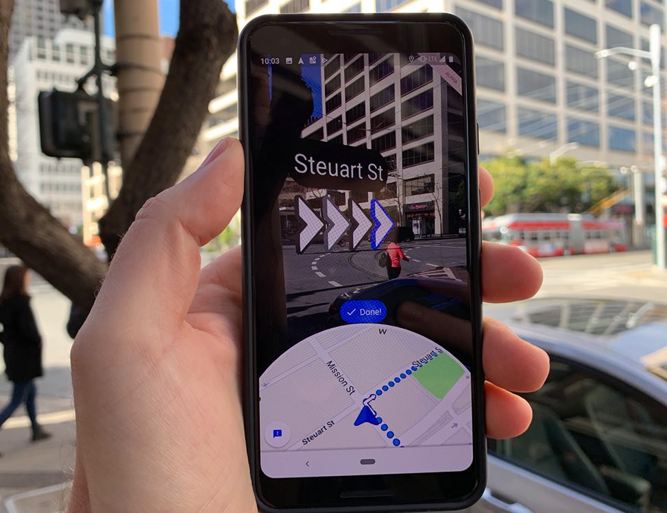
The mechanism is simple. The initial in-app directions computed by AR engines to actually pop arrows on to the maps. The arrows show up pointed to the side, on which the path is pinpointed right on the map. Thus users get a better idea of where to go next if they find it hard from the maps.
The only thing they need to do is to just fire up the camera, put up the camera to the streets. The arrows will show up for where to go next, as shown on the maps.
Also, read this How Google Maps Street View Works? Capturing Everything – Explained.
Google Maps Live view AR support
Only the Google Pixel phones came to be supporting this feature, as they come with a built-in AR kit. The update got released on to these phones for the first time, for a test drive. It became an easy delight to use the maps even more. Although most phones, with AR core or kit support, will be able to use this update on Maps.
How to use the Google Maps Live view

All you need to do is just fire up Google Maps.
- Navigate to the spot or location that you want to go for the time.
- On the bottom, there are the directions buttons. Click on it.
- Then come to the top of the screen and then select the walking directions button present.
- Click on the Live view option below.
- See if you can get the AR designated arrows on to your corners (you will if your phone supports the AR kit or has an AR core).